
Ship Island
This marker is located near the lighthouse in Jones Park on Beach Boulevard (U. S. Highway 90).
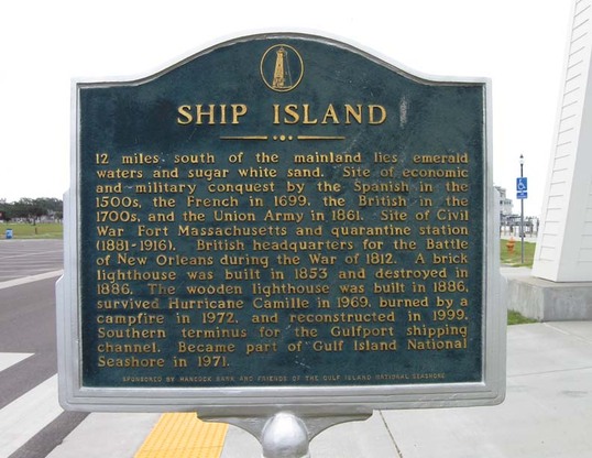
The text of the marker:
"SHIP ISLAND
12 miles south of the mainland lies emerald waters and sugar white sand. Site of economic and military conquest by the Spanish in the 1500's and the French in 1699, the British in the 1700's, and the Union Army in 1861. Site of Civil War Fort Massachusetts and quarantine station (1880-1916). British headquarters for the Battle of New Orleans during the War of 1812. A brick lighthouse was built in 1853 and destroyed in 1886. The wooden lighthouse was built in 1886, survived Hurricane Camille in 1969, burned by a campfire in 1972, and reconstructed in 1999. Southern terminus for the Gulfport shiping channel. Became part of Gulf National Seashore in 1971."
Photo courtesy of Joe and Sarah Casey
